Sometimes the trail less followed, even by mistake, can be a pleasant surprise. Our plan was to hike up Belknap Mountain’s Red Trail to a fire tower. This was supposed to be a family hike with about a 700 foot elevation gain (from the parking lot). This peak is about 600 feet higher than Mount Major and is supposed to have much nicer views.
 We drove up the Belknap Mountain Road and turned onto Carriage Road (see below for directions). We then reached a parking area near a gate. Unfortunately the gate was closed due to a tree down on a utility line. Forgetting that the trail began 1 mile past the gate, we started our hike. Shortly, we crossed a bridge and saw a red blazed trail on the right. We turned onto the trail and started our ascent.
 The trail had a gentle and continuous slope, but watch your step because there are plenty of roots and rocks to step over. Once you approach the summit there are lots of wild blueberries to pick, which is a good incentive for the children.
Continuing to the summit, we came to a large exposed ledge area. I noticed some people relaxing and I asked one of them where the fire tower was (since I did not see it). The man politely responded “The fire tower? That is over there,” as he pointed to the next mountain peak.
That is when I found out that we were on Piper Mountain. The Piper Mountain trail rises about 1,000 feet and is about 1 mile from the parking area. The peak elevation is approximately 2,000 feet above sea level. Piper Mountain is also part of the Belknap Range Trail, which runs from Mt. Rowe to Mt. Major. Be sure to check out the stone bench and chair on the summit. Unfortunately, the only view is northeasterly towards Lake Winnipesaukee.
 On our descent, we chose to take the blue/white blazed trail towards Belknap Mountain. We then joined the Belknap Mountain trail, and descended towards the Carriage Road. We came out on the road just below the parking lot that we originally planned on parking in. Now we had to walk about 1 mile down the road to our vehicle by the gate.
Overall the hike was good and it turned out better that we took the wrong red trail. We still want to hike Belknap Mountain to the fire tower and since we are hiking with kids (5 & 10 years old), we are hoping that the road will be open.
Finding the trail can be difficult, especially if you use a GPS. Our GPS sent us to the wrong side of the mountain where the Belknap Mountain Road is no longer passable.
From Laconia, take Route 3 to Route 11A. Follow 11A towards Gilford Village, then take a right onto Belknap Mountain Road. If driving from the Alton area, follow Route 11 to Route 11A. Follow 11A towards Gilford Village and turn left onto Belknap Mountain Road. Follow Belknap Mountain Road for 2.4 miles, then turn left onto Carriage Road. Once on Carriage Road the gate will be in about .5 mile.


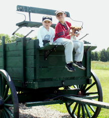
 If you drive along Route 4 between Durham and Dover Point, you will see a picturesque old wagon sitting on top of a hill at an old farm.
 forest and salt water shoreline.
  The walk is about 1.2 miles in length, but there are many interconnecting trails, which can make for longer, shorter or varying hikes. There is a trail on the opposite side of Route 4, but we have not been on that trail. We enjoyed our hike with our new puppy. Dogs are allowed if leashed.